I woke up today to find this comment left on a short video I’d posted of a trail section near the Condor River on the tassie trails facebook page:
Trevor Grigson Seriously, why the fuck would you even try to bike that? It’d be like biking the overland, yeah you’d get bragging rights, but it;d be yeah, I was stupid enough to do try it, and yeah it sucked but hey aren’t I a legend”
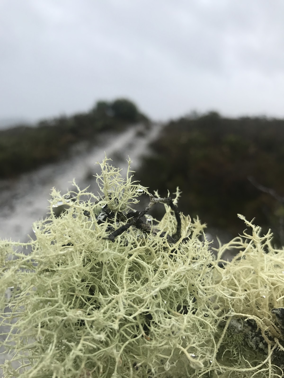
I have to admit that getting these sort of comments hurt, and I was about to respond by saying that some people just don’t understand the desire to explore, when I realised that in fact all that Trevor may have seen was a 30 second video snippet from an eight day trip, and it was, to be fair to him, a snippet of a particularly swampy section of trail just near the Condor river.
I suspect (hoped) he’d missed the background detail in these blog posts which was that the purpose of the trip was to do a track assessment for Parks and Wildlife and he had therefore mistaken my attempted humour about a ‘damp track with minor drainage problems’ for attempted heroism.
So let me dedicate this post to explaining to Trevor, and others like him, “why the fuck we tried to bike this” and let me start by showing a few other photos from that exact same spot on the Condor River …
 |
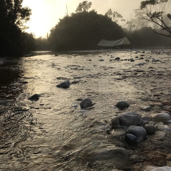
| Dawn on the Condor River – Note Tyrone’s Bivy |

 |
| Dawn at the Condor River |
 |
| Heading back up the road … |
… if you’re anything like me, you probably already want to go there.
But with that long prelude out of the way, let me get back to the first day on the track …
After our first night in the hut at Birches Inlet we were all up pretty early packing our bags and getting ready to finally explore the Low Rocky Point Track.
Again, for Trevor’s sake, we had all done a bit of research on the track, but what we had received were conflicting reports:
Tony had found two cyclists who had ridden the track in 2003, and their report was that the bikes were useful down to the Wanderer River, but beyond that they just became anchors. One of their main problems though was that they used panniers and their panniers had failed. They also noted that they were worried about riding many sections due to the slippery conditions and the worry of having accidents in such a remote area, resulting in a lot of pushing.
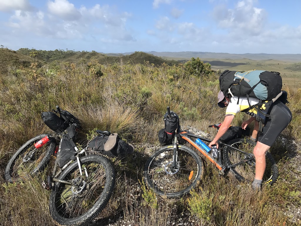
With our fat bikes (or at least wide tyres) and modern bike packing gear we were hoping to not have these same problems.


Offsetting this not so positive 2003 report, I had heard from several kayakers who had seen quad bike tracks on the beaches all down the West Coast, which correlated with other information we’d heard which suggested a level of illegal quad bike use along the track to access the coast.
This information suggested to us (well me at least) that the track (and bridges) were likely rideable and probably kept open (if you can get a quad bike through, we figured you can get a mountain bike through).
So we weren’t expecting epic days of doom and gloom, or days of pushing through mud and thick scrub; we were expecting a hard but a rewarding ride ending in a few days exploring a beautiful and wild remote coast (seriously go and have a look on google earth) before we pushed back north and did it all again.
I was expecting an adventure.
In fact such was my optimism in the hut that first morning, that I recall saying something along the lines of “while we should aim for the Wanderer River today, if we have a good day and find ourselves there earlier than expected, we might still make it down to the Lewis River or even Cowrie Beach tonight.“
In fairness, I do recall Bob responding to this burst of optimism by saying something along the lines of “you enjoy that fantasy“.
Then our last bags were stuffed and closed, the obligatory ‘before’ photo taken, and we set off down the track joking about how long we’d be able to keep our feet dry for and how good those beers and steaks are going to taste when we get back …
 |
| Last minute packing. |
 |
| The trail begins. |
As anyone who had ever done a long distance race or competition will know, one of the secrets of getting to the end of an endurance effort is not to judge the whole effort by the moment you’re in – especially when the doubts creep in.
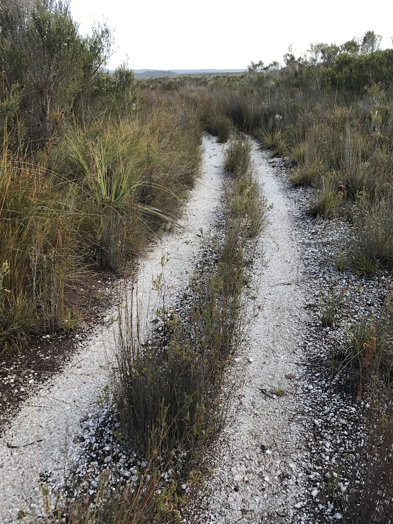
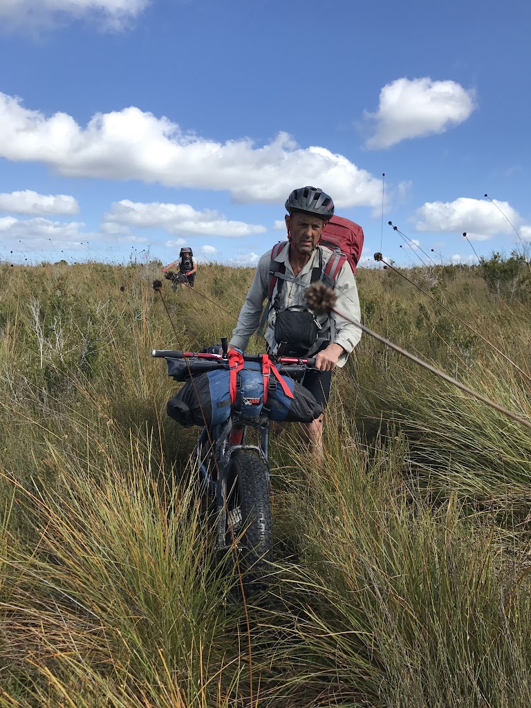
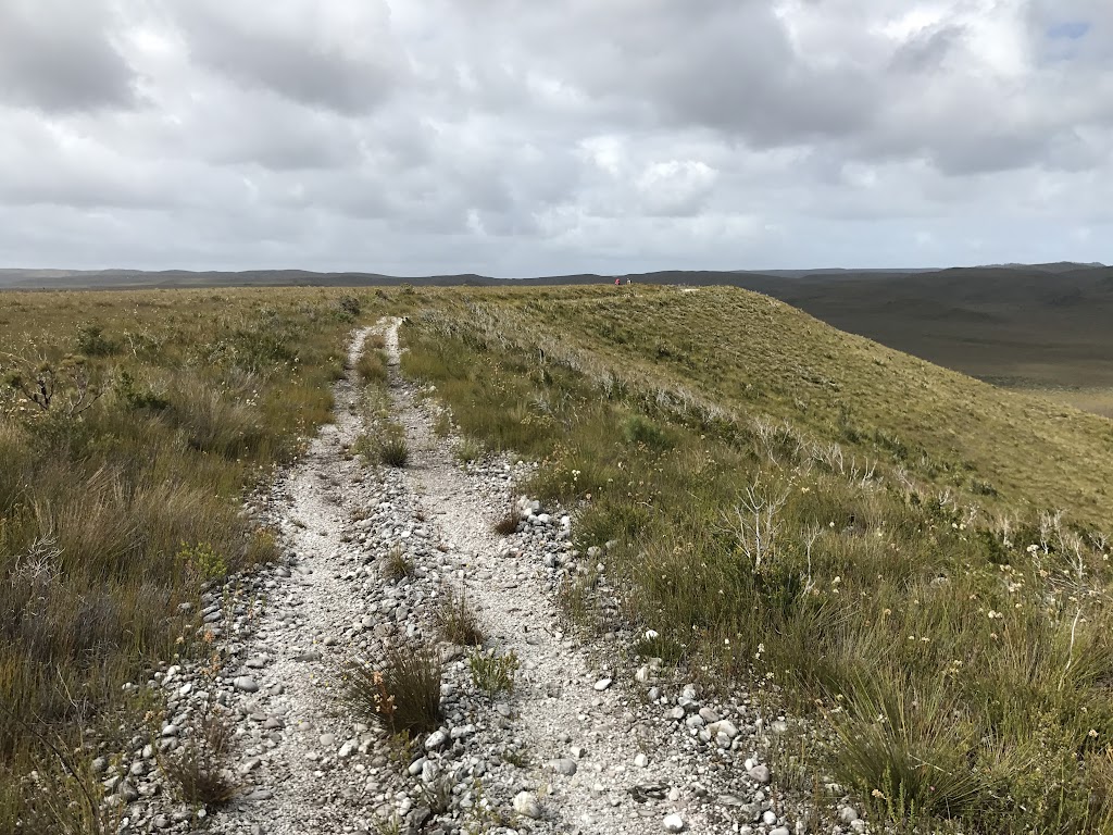
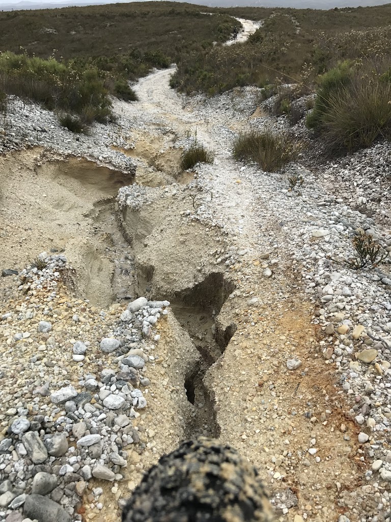
I don’t have any photos of the first kilometre or so of the track from Birch’s Inlet, partly because about 300 metres into the ride, my back wheel slipped out of it’s mount (Surly ECR’s don’t have through axles, instead requiring manual alignment of the wheel) and after a complicated process of getting it back in again, I was playing a very defensive mind game with myself trying to convince myself that it was still a good idea to head off down a 72km remote road on a bike that seemed about to fall apart, and partly because the trail basically was like this …

These photos were taken on the way back, but they are of the first section of trail.
However, after the first kilometre or so, the trail started to become a bit more distinct and although there were many puddles and short, steep ascents that we really had to work hard to get over given all of the gear on the bikes, we started making progress …
 |
| Notice the backpacks |

About 4kms into the ride, we crossed Birch’s Creek, which had quite a lot of water in it, before ascending up a steep eroded track onto the top of a Moraine.
 |
| Crossing Birch’s Creek |
 |
| Crossing Birch’s Creek |
 |
| Our first ascent (this is the good bit – it got worse) |
 |
| This is the first ascent (but on our way back) |
 |
| On top of the moraine |
 |
| The track before us … |
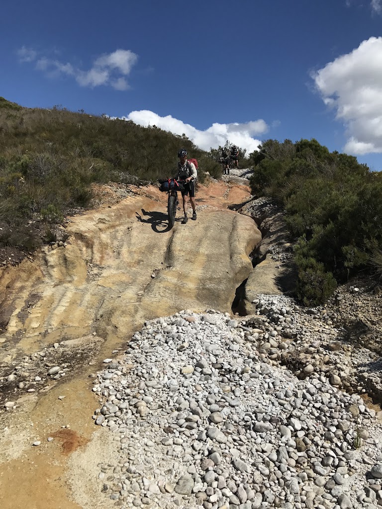
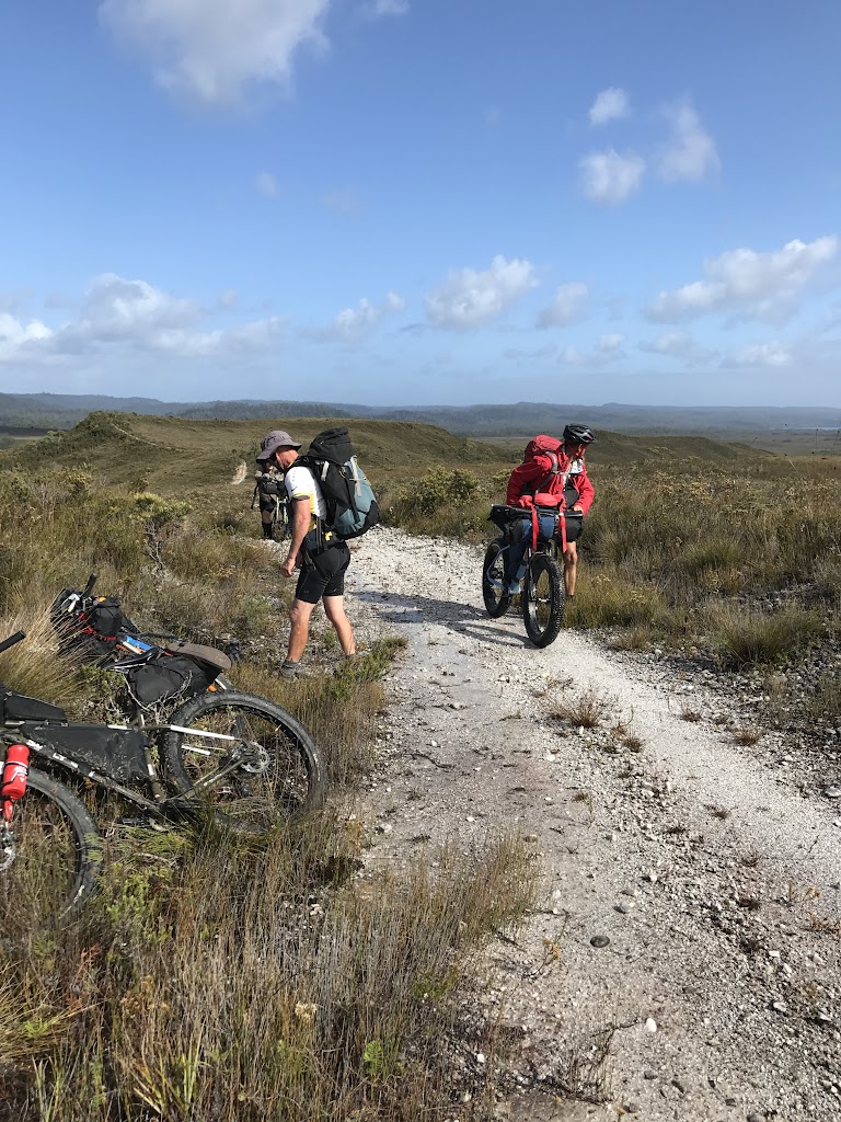
It had taken us about an hour and a half to travel the first five kilometers to this point, but fortunately once we were on top of the moraine, we found ourselves in a whole new world with a flat, ride-able trail skirting the very edge of the moraine’s escarpment making for great views (albeit that we could see the trail winding up over the hills in the distance) and so with spirits lifted we just enjoyed the mornings riding as we slowly (and mostly unknowingly) climbed from around 100 metres above sea level to 325 metres by kilometre 20 where we had lunch.


 |
| There were a few steep pinches. |

 |
| On top of a steep bit looking back over the trail we’d ridden. |
Just in case anyone ever follows this trail, I did say that the ascent was mostly unnoticed. There are a few sections in there when it felt like we were on an obstacle course pushing our bikes up nearly sheer hills and plunging back down again through big rocks and puddles.
A real highlight of this section was watching all the parrots launching out of the button grass down the escarpment as we pedaled past (we couldn’t tell if they were orange bellied parrots, because they would only ever show us their backs).
Lunches weren’t quick affairs as we’d all made the decision to pack dehydrated pasta to cook for lunch as flat bread and other condiments for six days were too heavy and bulky to carry (Bob was the exception here and we all drooled as he ate peanut butter and honey flat breads for lunch and breakfast).
My usual lunch consisted of a two dollar packet of alfredo or carbonaro pasta from woolies, with a few slices of peperoni and some dried peas (the peas were an unexpected extra provided by Tyrone and which went down so well that they became my favourite food of the trip).
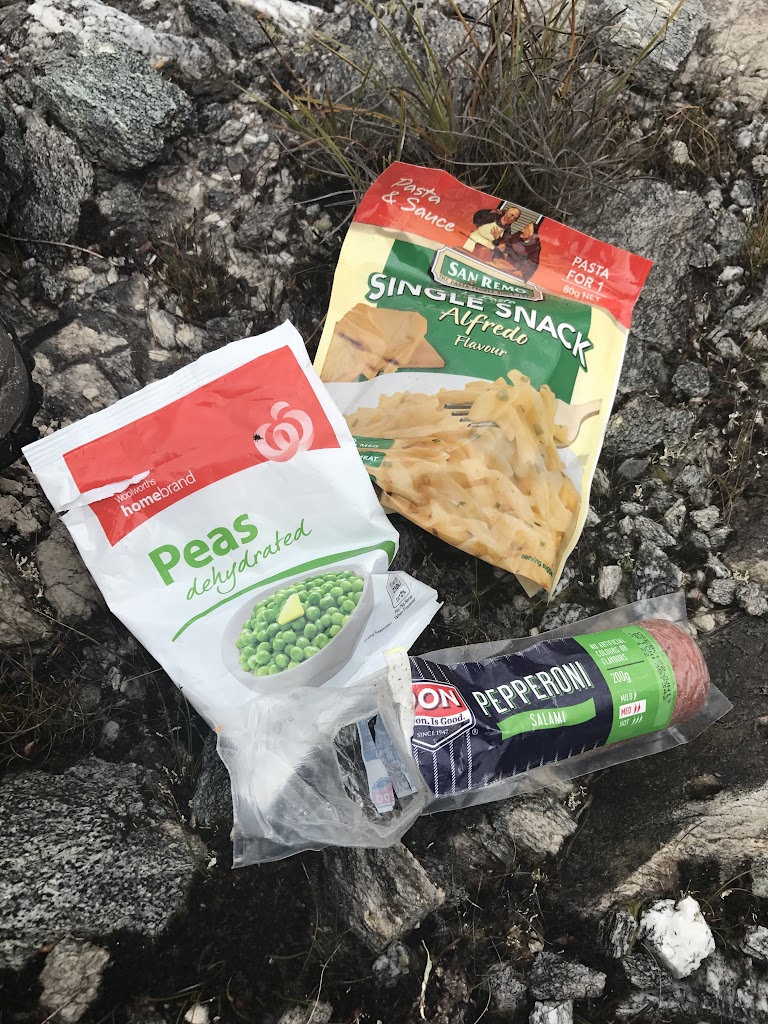

This was usually washed down by a cup of tea.
After lunch we continued on towards what was to be our first ’emergency’ campsight in our original plan – Pery River which was about 25kms from Birch’s Inlet.
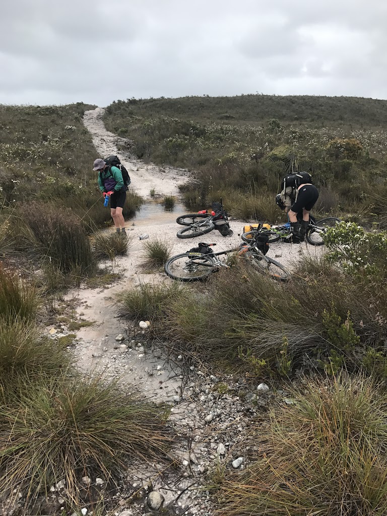 |
| Pery River (small flow beyond bikes) |
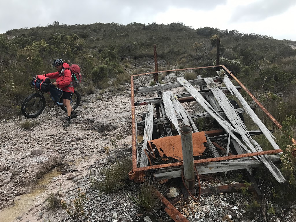 |
| Abandoned Trailer at Pery River – I would love to know its story. |
 |
| Fish in Pery River (on the return) |
The Pery river was very small, but did have good flow on the way in (but a lot less on the way out). It even had fish in it, and we could have made a camp here if needed (enough flat ground) albeit that it would have been very exposed, especially for the bivy’s.
But we still had 10kms to go before the Condor River which was the minimum distance we all wanted to travel today.
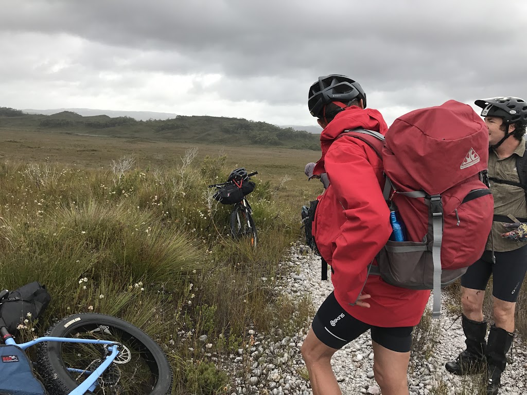
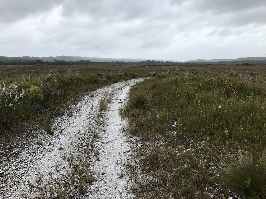
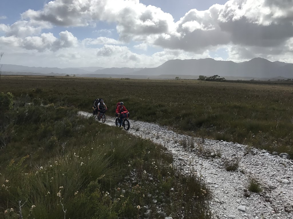
Now, I’d like to say at this point that spirits were high and we were thundering along, and to an extent that was true (we were in a magical place and mostly enjoying the riding), but at the same time, we’d been riding for about 4 or 5 hours at this stage, we were travelling much slower than anticipated, and from where we were we could see the track we had to ride stretching out in front of us for what seemed like an infinity as it followed the edge of the escarpment.
The depressing aspect was the way that we could see the track, like a white scar, climbing virtually every ridge in front of us, and with tired legs, I think each of us (well at least Tyrone and me) had a few ‘struggle’ moments over the next two hours.
 |
| The surface was mainly ridable |
 |
| The track looking forward – winding around the escarpment. |
 |
| The riding was never easy either – this washout was about a metre deep. |
I had my first crash sometime that afternoon as I misjudged a descent and went over the handlebars, but eventually, after what seemed a lot of ups and downs, we got to the bottom of the last descent before the Condor River to find Bob sitting on the side of the track (he was by far the fittest and fastest of us today, always out front scouting the track) telling us he’d found us a campsite for the night on the ridge.
What followed then was one of those farcical discussions between four very tired men, none of whom wanted to be responsible for making the wrong decision, about whether we should leave our bikes here and walk the 500 metres down to the river to check it out or whether we should take our bikes and gear with us just in case there was a better campsite down by the river (so we wouldn’t have to come back up again).
Eventually we decided to take the bikes to the river, just in case, and thankfully this turned out to be the right decision as we found a lovely flat piece of ground right next to the river to put up our tents and bivys (Bob and Tyrone had opted to take Bivy’s to cut down on weight).
 |
| Condor Creek Campsite |
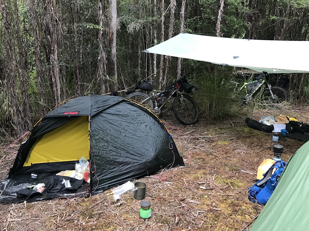 |
| Condor Creek Campsite |
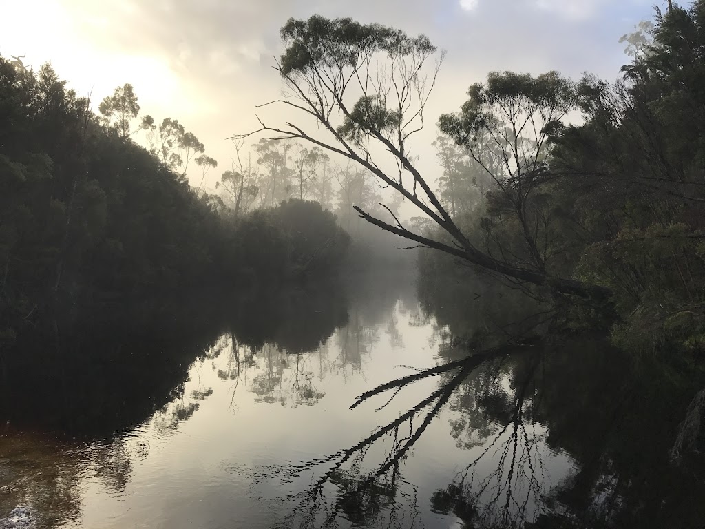
The downside of this decision was we discovered something that none of us had expected … it looked like we couldn’t get across the Condor River.
Now nowhere in our research had we ever encountered any mention of the Condor River, so we’d just assumed it was a small creek that we could easily ford, but when we got there we found something entirely different …

Both Tyrone (above in the photo in the distance) and I tried to get across the river, and at the time we didn’t know if it was due to recent high rainfalls scouring out the river or something else, but neither of us could get across the last section of fast flowing, deep water on the other side of the river … especially with a big log strainer just 10 metres down stream from the crossing.
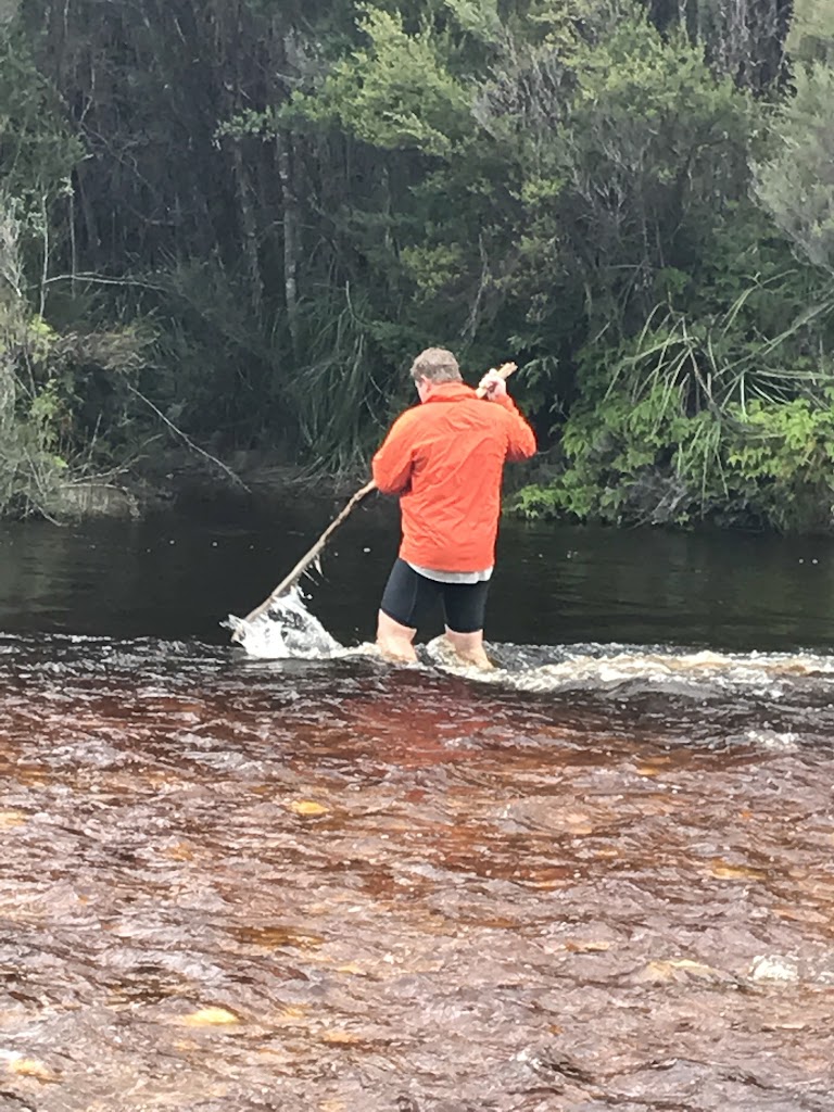 |
| A tentative approach |
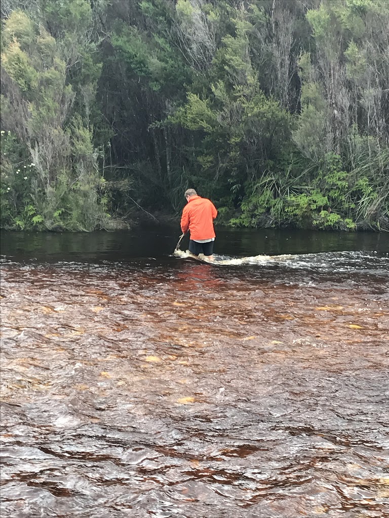 |
| That “oh, this may be harder than it looked” moment |
 |
| And the retreat … |
It was therefore with mixed emotions that we ended day one.
We had put a stick on the edge of the water just after we arrived, and after a few hours it was clear that the water level was dropping. Tyrone was particularly upbeat about our prospects of getting across, figuring we’d be more determined to get across tomorrow and would therefore find a way, but me – I was thinking about what the unexpected Rise of the Condor would mean for our chances of getting across the Wanderer and Lewis Rivers, even if we were successful in getting across the Condor tomorrow.
And it was with these thoughts going around my mind, that I fell asleep.
Postscript: On returning to Strahan we ran into one of the retired parks rangers who knew the track well and he informed us that he knew of groups that had been stuck on the other side of the Condor River for up to two weeks waiting to get across. So don’t underestimate the Condor River.
Next time you need to feel the need to respond, say "Because I fucking can!" No other reason need.